


The study region
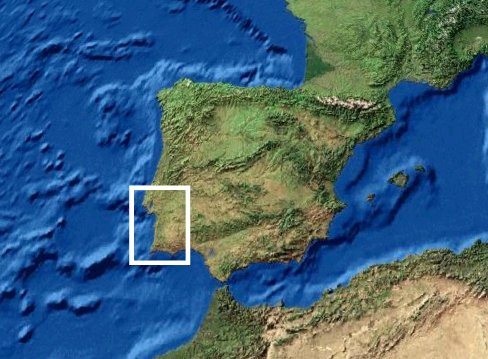 The target area of the SRDS survey is the Sado river basin
(southern
Alentejo, Portugal), a large, sedimentary basin with an area of 7692
km2 and a mean altitude of 127 meters asl.
The Sado flows for 180 kilometers
in a northerly direction from its source in the Serra da Vigia (230 m
asl) before changing its course and flowing west towards the Atlantic
ocean. Southern Alentejo forms part of the Iberian Pyrite Belt, largely
composed of late Devonian and Cambrian volcanic rocks (tuffs,
rhyolites, etc) overlain by metamorphic and sedimentary deposits
(including siliceous formations, jaspers, cherts, schists, grauvaques
and conglomerates). These deposits form the economic basis of a
once-thriving and still active mining industry (Barriga and Carvalho
1997; Martins, Alves, and Costa 2002-2003). The sediments filling the
hydrological basin are mostly detritic and continental, overlying
marine sediments of Miocene age. Plio-Pleistocene sediments deposited
on the broad erosional surface that formed as the sea retreated (the
planalto
deposits) were in turn dissected and reworked by the river
system that began forming during the Pleistocene. The region is
caracterised by poorly developed soils (mainly derived from bedrock
schists).
The target area of the SRDS survey is the Sado river basin
(southern
Alentejo, Portugal), a large, sedimentary basin with an area of 7692
km2 and a mean altitude of 127 meters asl.
The Sado flows for 180 kilometers
in a northerly direction from its source in the Serra da Vigia (230 m
asl) before changing its course and flowing west towards the Atlantic
ocean. Southern Alentejo forms part of the Iberian Pyrite Belt, largely
composed of late Devonian and Cambrian volcanic rocks (tuffs,
rhyolites, etc) overlain by metamorphic and sedimentary deposits
(including siliceous formations, jaspers, cherts, schists, grauvaques
and conglomerates). These deposits form the economic basis of a
once-thriving and still active mining industry (Barriga and Carvalho
1997; Martins, Alves, and Costa 2002-2003). The sediments filling the
hydrological basin are mostly detritic and continental, overlying
marine sediments of Miocene age. Plio-Pleistocene sediments deposited
on the broad erosional surface that formed as the sea retreated (the
planalto
deposits) were in turn dissected and reworked by the river
system that began forming during the Pleistocene. The region is
caracterised by poorly developed soils (mainly derived from bedrock
schists).
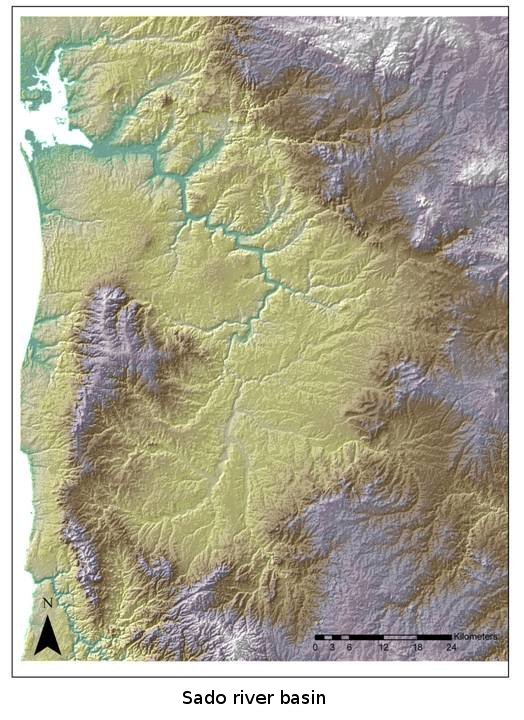 The history and topography of the target region is heavily
influenced by tectonic processes. Subsidence of the Sado basin and the
formation of the Grândola horst at the beginning of the Quaternary
(Pimentel & Azevedo 1991) resulted in distinctly different
sedimentary histories in the northern and southern halves of the Sado
drainage system. The northern part of the drainage, from Grândola to
the estuary, forms part of the litoral platform; sediments in this
sector are predominantly composed of fine sands, easily remobilised by
aeolian processes. Fluvial terraces in the northern sector are
difficult to identify or age (Pimentel 1989). The southern part of the
drainage, from Grândola to the Serra da Vigia, is essentially an
extended erosion surface upon which a braided fluvial system formed
during the Plio-Pleistocene, depositing a succession of sandy, detritic
sediments cloaked with coarse rañas (Pimentel 1989, Pimentel and
Azevedo 1991). South of Grândola, the Sado river is weakly incised
forming two, heavily dissected terraces (Pimentel 1989, Pimentel and
Azevedo 1991).
The history and topography of the target region is heavily
influenced by tectonic processes. Subsidence of the Sado basin and the
formation of the Grândola horst at the beginning of the Quaternary
(Pimentel & Azevedo 1991) resulted in distinctly different
sedimentary histories in the northern and southern halves of the Sado
drainage system. The northern part of the drainage, from Grândola to
the estuary, forms part of the litoral platform; sediments in this
sector are predominantly composed of fine sands, easily remobilised by
aeolian processes. Fluvial terraces in the northern sector are
difficult to identify or age (Pimentel 1989). The southern part of the
drainage, from Grândola to the Serra da Vigia, is essentially an
extended erosion surface upon which a braided fluvial system formed
during the Plio-Pleistocene, depositing a succession of sandy, detritic
sediments cloaked with coarse rañas (Pimentel 1989, Pimentel and
Azevedo 1991). South of Grândola, the Sado river is weakly incised
forming two, heavily dissected terraces (Pimentel 1989, Pimentel and
Azevedo 1991).
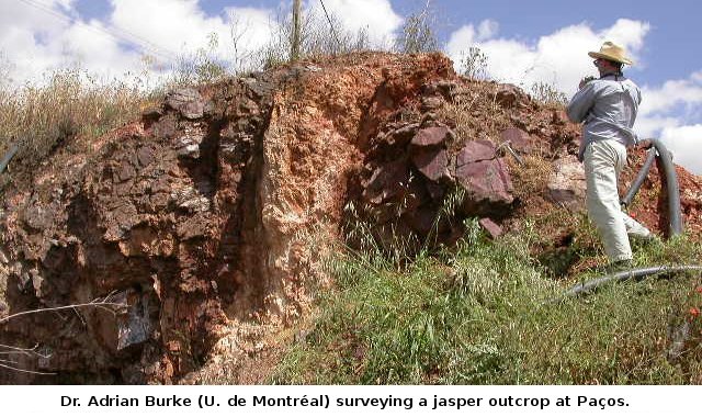
Raw material sources
Primary sources of raw material suitable for knapping are rare in the survey region. There are no known sources of flint, although chert is occasionally encountered in very small quantities. Jasper occurs in outcrops on the margins of the Sado basin, especially in the south of the survey region. Other potential raw materials including quartz, quartzite, grauwacke and jasper cobbles, occur in secondary contexts throughout the drainage system.