


Survey design
 Geological maps, produced by the Intituto Geológico Mineiro
(IGM), were obtained from the Departamento de Geologia, Instituto
Nacional de Engenharia, Tecnologia e Inovacão (INETI) at a national
scale of 1:200,000 meters. Regional scale geological maps (1:50,000
meter) were obtained but are only available for approximately half of
the study region. Topographic maps at 1:25,000 meter scale covering the
entire region were obtained from the Instituto Geográfico do Exercito
(IGeoE). Aerial photographs were consulted online via the Centro
Nacional de Informação Geográfica (CNIG; now SNIG) website.
Geological maps, produced by the Intituto Geológico Mineiro
(IGM), were obtained from the Departamento de Geologia, Instituto
Nacional de Engenharia, Tecnologia e Inovacão (INETI) at a national
scale of 1:200,000 meters. Regional scale geological maps (1:50,000
meter) were obtained but are only available for approximately half of
the study region. Topographic maps at 1:25,000 meter scale covering the
entire region were obtained from the Instituto Geográfico do Exercito
(IGeoE). Aerial photographs were consulted online via the Centro
Nacional de Informação Geográfica (CNIG; now SNIG) website.
A systematic, stratified survey was undertaken during the summer months from 2005 to 2008. Survey strata include:
- All river terraces along the Sado and its major tributaries;
- A series of small bodies of water (“lagoas” and “lagoinhas”) mapped or visible in aerial photographs in the planalto southwest of Grândola;
- Jasper outcrops and other potential sources of raw material in primary position.
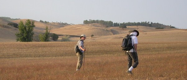
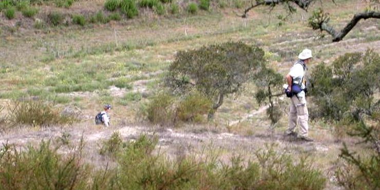 Survey members worked in teams of 3-5, walking parallel transects
approximately 5 meters apart, equipped with WAAS enabled GPS units
(Garmin© eTrek). Tracks were automatically recorded and
archaeological finds individually recorded as waypoints and collected.
The GPS data were uploaded to a laptop at the end of each day and
MapSource© used to post-process the information. Tracks and waypoints
were retained, recording the distances covered by each operator and the
location of archaeological materials. These data were then saved in a
format compatible with ArcGIS 9.2 (ESRI ©) before being uploaded to the
GIS. The data were merged by survey area and projected onto digitally
stored topographic maps to visually check the day’s work. This ensured
that survey intensity and coverage, as well as the number and location
of artefacts and their relative density could be calculated.
Survey members worked in teams of 3-5, walking parallel transects
approximately 5 meters apart, equipped with WAAS enabled GPS units
(Garmin© eTrek). Tracks were automatically recorded and
archaeological finds individually recorded as waypoints and collected.
The GPS data were uploaded to a laptop at the end of each day and
MapSource© used to post-process the information. Tracks and waypoints
were retained, recording the distances covered by each operator and the
location of archaeological materials. These data were then saved in a
format compatible with ArcGIS 9.2 (ESRI ©) before being uploaded to the
GIS. The data were merged by survey area and projected onto digitally
stored topographic maps to visually check the day’s work. This ensured
that survey intensity and coverage, as well as the number and location
of artefacts and their relative density could be calculated.
Archaeological testing
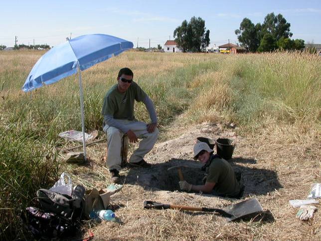 Field testing (sondages) was conducted in 2006 and 2007 at
four of the
most promising locations (Mina do Paços, Gasparoes, Moinhos II and
Vermelha). Excavation revealed that the archaelogical remains lie
within the modern plough zone (less than 40 cm below the current soil
surface). Below the plough zone, artefacts counts drop dramatically or
cease altogether.
Field testing (sondages) was conducted in 2006 and 2007 at
four of the
most promising locations (Mina do Paços, Gasparoes, Moinhos II and
Vermelha). Excavation revealed that the archaelogical remains lie
within the modern plough zone (less than 40 cm below the current soil
surface). Below the plough zone, artefacts counts drop dramatically or
cease altogether.